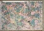
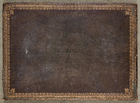
Freke Estate (Cork) Survey of 1787/88 by Thomas Sherrard
Sir John Freke (1765-1845), who succeeded to the title of 6th Baron Carbery on the death of his cousin John Evans, fifth Baron Carbery in 1807, was an extensive Munster landowner of the late eighteenth/early nineteenth century. Thomas Sherrard (1750-1837), a prominent Dublin-based land surveyor, learned his profession as an apprentice to Bernard Scalé (1738-1826), the most notable pupil of the renowned 18th century Huguenot cartographer John Rocque (c. 1705-1762), who revolutionised cartography and surveying in Ireland during the circa six years he spent based in Dublin during the 1750s. As well as his salaried public appointment as surveyor and secretary to the Dublin Wide Streets Commission (Sherrard Street, Upper and Lower, in Dublin is named after him), Sherrard was a leading player in the business of mapping and valuing private estates in Ireland. (see History Ireland article by P. Duffy, St. Patrick’s College, Maynooth, and references therein, for an overview of 18th century estate maps). One of these commissions was to carry out a survey of the County Cork holdings of the Freke estate. A black and white photostat copy of this survey in good condition is held by the National Library of Ireland (Manuscript Map 21 F 105).
The original document survives intact in private hands,
information that came to the author’s attention several
years ago courtesy of his cousin Joseph McCarthy. Its
custodian, the Dean of Ross, Christopher Peters, has
generously granted UCC access to digitize the document, and
the digitization work was carried out in 2017 by Mr. Tomas
Tyner of UCC Audio Visual Services with funding provided by
UCC School of History. The document, of width 73 cm and
height 52.5 cm, comprises a front cover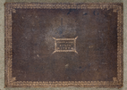 and title page
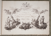 , both
dated 1787, a 'General
Survey'
 showing the relative locations (identified
by page numbers) of all maps, and 37 numbered survey maps
for 46 townlands (55 when including cases where single
townlands in the survey correspond to multiple townlands
today), distributed across 14 civil parishes in three
baronies stretching from Durrus at the mouth of Dunmanus Bay
to Athnowen near Cork City. With the exception of Maps 5,11
and 28 which are undated, all maps are dated 1788. A reference
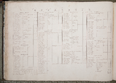 for the town
of Rosscarbery
 (Map 17, which is framed) tabulates occupier names and
corresponding house indices for some 140 dwellings and a
minimum of 126 distinct occupiers (when multiple ocurrences
of the same name are assumed to relate to one individual).
The breakdown in dwelling categories is as follows: 90
cabins, 37 houses and 14 slate houses which equates to an
approximate percentage breakdown of 65:25:10. A similar reference
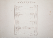 for the
Borough of
Baltimore
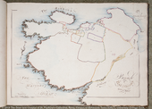 lists the 20 distinct occupiers of 28
dwellings or land holdings, whose locations are identified
on Map 21. With the exception of Map 17, all maps are on a
scale of 1 inch to 20 perches, or 1:3960. An index of all
townlands
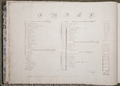 in the survey, together with their
acreages, is also included and gives the total area of the
surveyed lands as 15, 276 statute acres (with minor
exclusions).
The main table below (Table 1) with the title 'Townland
Survey Maps' comprises nine columns, the contents of which
are described in the column headings. The individual survey
maps are accessed from the first column. The linked image
corresponds to the survey page number given in the second
column. These page numbers are shown both in the 'General
Survey' and in the 'Index of townlands
 '. In most
cases, the boundary of a townland in the survey is readily
identifiable with the current townland boundary (accessed
via links provided to townlands.ie in the third column),
albeit often with an implicit rotation (by as much as 90
degrees, see for example the townland of Clodagh, Map 27) of
the survey map given that the North Arrow is rarely pointing
straight upwards, and moreover is frequently oriented
incorrectly. In general, the 1787/88 and current boundaries
match very well, and this is mirrored by the similarities
between the survey acreages given in column eight and those
taken from townlands.ie in column nine (the letters a, r, p refer to acres,
roods, perches (recte square perches); one acre = four roods and one rood =
forty (square) perches and all quantities are in statute measure).
In some instances, however, additional composite maps are
provided via links in the second column. These were deemed
necessary where the correspondence between 1787/88 and
current townland boundaries is not easily discernible, or
where a single townland boundary in the survey encompasses
multiple present-day townlands. This is most pronounced in
the case of Bally Island (Map 26 of the survey), where what
is described as a single townland of 823 statute acres
encompasses (with minor boundary changes) no fewer than six
distinct townlands today. The converse also occurs, e.g. in
the case of the modern townland of Curraghbeg (Athnowen
civil parish) where the same boundary encompassed three
separate townlands in 1787/88 (see Maps 32-34). In such
cases, the acreages given in columns eight and nine
disagree; however curly brackets in one of the two final
columns are used to indicate a grouping of vertically
adjacent acreages whose sum, in each of the four cases where
this circumstance arises, is very close to the corresponding
unbracketed total acreage in the other column.
In eight of the 37 maps (Maps 4,10,11,13,16,18,19 and 24) the names of individual tenants and the location of their holdings are specified. This information is reproduced in Table 2 with the title 'Named tenants and their holdings'.
The information in the Town of Old Ross reference is reproduced in Table 3 ('Reference for Town of Old Ross'). In like manner, the information in the Borough of Baltimore reference is reproduced in Table 4 ('Reference for Borough of Baltimore').
All but one of the maps contain information on lands bordering Freke Estate lands and their owners. This information is reproduced in Table 5 with the title 'Adjacent lands (not belonging to the Freke Estate) and their owners '. It also includes occasional topographical features.
A lettings advertisement for circa two
thirds of the lands included in the 1787/88 survey appeared
in the Cork
Evening Post edition of 31/8/1786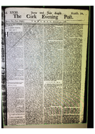 (referenced in
"Old World Colony, Cork and South Munster 1630-1830", David
Dickson, (CUP, 2005) p.341). This
reproduction of the advertisement
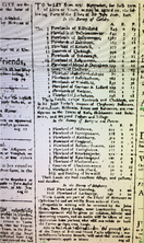 from microfiche
(courtesy of the National Library of Ireland) is of
sometimes challenging legibility, and for convenience the
contents are provided in the form of a transcription
presented in Table 6(a-c) with question marks appended to
poorly legible text. (Text from the advertisement is in
italics or enclosed in quotes to differentiate it from notes
referring to the tables.) It includes the number of
plowlands (sic) in each townland as
well as townland acreages. The wide variation in the
acreages associated with each ploughland - ranging from 101
acres for one ploughland in the case of Milltown to 456
acres per ploughland for the three ploughlands of
Ballycomaune - reflects the use of the ploughland measure as
an indicator of the quality of the land rather than of a
fixed acreage: Milltown is described on Map 4 as "Arable
Meadow and Pasture" whereas only 266 acres of Ballycomaune
(Middle Division) is rated as "Arable and Pasture",
corresponding to 87 acres of good land per ploughland. Of
the remaining land, 318 acres is labelled "Course Mountain
Pasture" and the balance of 730 acres is described as
"Arable and Mountain Pasture". The 1787/88 survey acreages,
as recorded by Sherrard in the course of the two years
following this advertisement, are reproduced in the last
column for comparison. Spelling of townland names in the
advertisement deviates, sometimes significantly, from those
of the survey in the first column of the main table.
Pádraig Mac Cárthaigh, Earrach, 2019
(I wish to thank Kenneth Nicholls and Paul MacCotter for their invaluable guidance in preparing these notes and Andy Bielenberg for pointing me towards the work of David Dickson. I take sole responsibility, however, for any inaccuracies that may lurk in the text.)
Civil Parishes and Townlands in the Freke Estate (Cork) Survey of 1787/88 by Thomas Sherrard
Thomas Sherrard
Civil Parishes and Townlands in the Freke Estate (Cork) Survey of 1787/88 by Thomas Sherrard
Civil Parishes with number of survey townlands and parish total listed. (Links courtesy of townlands.ie; leaganacha Gaeilge buíochas le logainm.ie)
- Ross (An Ros) (10 of 40 townlands)
- Rathbarry (Ráth an Bharraigh) (10 of 21 townlands)
- Lislee (Lios Lao) (1 of 31 townlands)
- Kilkerranmore (Cill Chiaráin Mhór) (5 of 27 townlands)
- Fanlobbus (Fán Lóbais) (1 of 83 townlands)
- Castleventry (Caisleán na Gaoithe) (1 of 16 townlands)
- Kilfaughnabeg (Cill Fachna Bheag) (1 of 17 townlands)
- Tullagh (An Tullach) (3 of 36 townlands)
- Creagh (An Chraobhach) (7 of 33 townlands)
- Aghadown (Achadh Dúin) (6 of 44 townlands)
- Caheragh (Cathrach) (1 of 57 townlands)
- Dromdaleague (Drom Dhá Liag) (1 of 52 townlands)
- Durrus (Dúras) (1 of 27 townlands)
- Athnowen (Áth na nUamhann) (7 of 12 townlands)
Table 1: Townland Survey Maps (Leaganacha Gaeilge buíochas le logainm.ie)
| Townland map from Freke Estate Survey | Map number (old/new boundaries) | Modern name and boundary | Leagan Gaeilge | Civil Parish | Barony in Survey Index | Barony in townlands.ie | Land Area in Survey | Land Area in townlands.ie |
|---|---|---|---|---|---|---|---|---|
Castlefreke
Domain 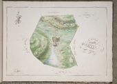
|
1 (1787/88
and modern boundaries)
| Castlefreke | Ráth an Bharraigh | Rathbarry | Ibaune and Barryroe | Ibane | 325 a 2 r 5 p | 381 a 3 r 36 p |
Castlefreke
Domain Reference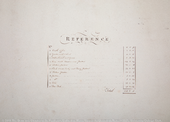
| Castlefreke | Ráth an Bharraigh | Rathbarry | Ibaune and Barryroe | Ibane | |||
Warren of
Castle Freke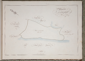
| 2 | Castlefreke-Warren | An Coinicéar | Rathbarry | Ibaune and Barryroe | Ibane | 163 a 3 r 27 p | 192 a 2 r 8 p |
Castlefreke
Island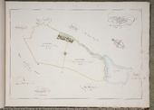
|
3 (1787/88
and modern boundaries)
| Castlefreke-island | Oileán Ráth an Bharraigh | Rathbarry | Ibaune and Barryroe | Ibane | 229 a 3 r 10 p | 204 a 0 r 6 p |
Carrigfadeen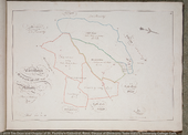
|
4 (1787/88
and modern boundaries)
| Carrigfadeen | Carraig Pháidín | Rathbarry | Ibaune and Barryroe | Ibane | 152 a 2 r 26 p | 79 a 0 r 33 p |
Maullatrahane
|
4 (1787/88
and modern boundaries)
| Maulatrahane | Meall an tSrutháin | Rathbarry | Ibaune and Barryroe | Ibane | 65 a 0 r 0 p | 112 a 0 r 3 p |
Milltown
|
4 (1787/88
and modern boundaries)
| Milltown | Baile an Mhuilinn | Rathbarry | Ibaune and Barryroe | Ibane | 103 a 3 r 32 p | 81 a 0 r 5 p |
Gortagreenaune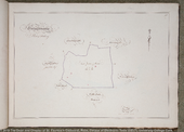
| 5 | Gortagrenane | Gort an Ghrianáin | Rathbarry | Ibaune and Barryroe | Ibane | 119 a 0 r 20 p | 121 a 3 r 16 p |
Little Island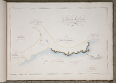
| 6 | Little-Island | An tOileán Beag | Rathbarry | Ibaune and Barryroe | Ibane | 118 a 3 r 5 p | 121 a 0 r 6 p |
Knocknagapple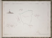
| 7 | Knocknagappul | Cnoc na gCapall | Rathbarry | Ibaune and Barryroe | Ibane | 102 a 1 r 0 p | 100 a 1 r 22 p |
Knocknagehee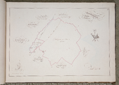
| 8 | Knocknageehy | Cnoc na Gaoithe | Ross | Ibaune and Barryroe | East Carbery (West Division) | 247 a 0 r 39 p | 249 a 0 r 32 p |
Ballymackshoneene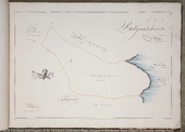
| 9 | Ballymacshoneen | Baile Mhic Sheoinín | Lislee | Ibaune and Barryroe | Barryroe | 235 a 0 r 5 p | 239 a 2 r 1 p |
Woodfield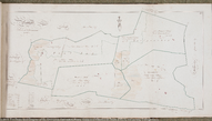
|
10 (1787/88
and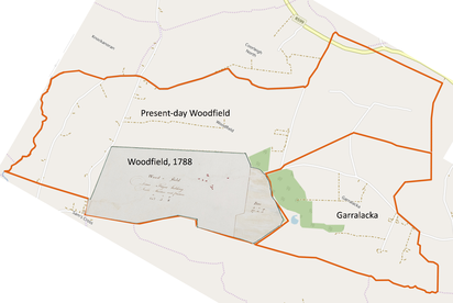 modern
boundaries)
| Woodfield | Doire Luain | Kilkerranmore | Ibaune and Barryroe | Ibane | {169 a 3 r 8 p | 603 a 1 r 27 p |
Paulbeg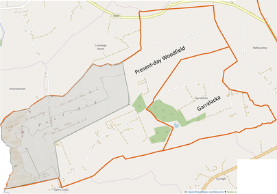 (Part of modern Woodfield)
| 10 | — | (Ainm Gaeilge le deimhniú) | Kilkerranmore | Ibaune and Barryroe | Ibane | {241 a 0 r 32 p | - |
Ballyvackey*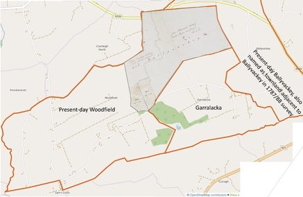 (Part of modern Woodfield)
| 10 | — | Baile an Bhacaigh | Kilkerranmore | Ibaune and Barryroe | Ibane | {190 a 3 r 15 p | - |
Gorralocka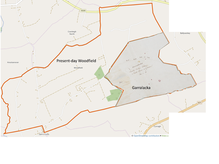 (1787/88 and modern boundaries)
| 10 | Garralacka | Garbhleaca | Kilkerranmore | Ibaune and Barryroe | Ibane | 233 a 0 r 13 p | 228 a 2 r 39 p |
Maullicorcoran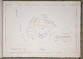
| 11 | Maulycorcoran | Meall Uí Chorcráin | Kilkerranmore | Ibaune and Barryroe | Ibane | 135 a 3 r 19 p | 135 a 3 r 19 p |
Keenrath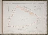
| 12 | Keenrath | Caoinráth | Fanlobbus | East Carbery (West Division) | East Carbery (West Division) | 417 a 1 r 8 p | 428 a 2 r 25 p |
Coolcraheen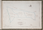
| 13 | Coolcraheen | Cúil Chraithín | Castleventry | East Carbery (West Division) | East Carbery (West Division) | 288 a 0 r 14 p | 270 a 3 r 39 p |
Cahirbeg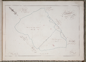
| 14 | Caherbeg | An Chathair Bheag | (Ross) Rathbarry | East Carbery (West Division) | East Carbery (West Division) | 363 a 1 r 20 p | 370 a 3 r 7 p |
Garrane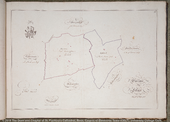
| 15 | Garrane | An Garrán | Ross | East Carbery (West Division) | East Carbery (West Division) | 132 a 3 r 20 p | 133 a 0 r 24 p |
Lissard
| 15 | Lissard | An Lios Ard | Ross | East Carbery (West Division) | East Carbery (West Division) | 86 a 3 r 25 p | 88 a 0 r 19 p |
Bohenaughts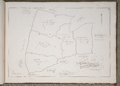
| 16 | Bohonagh | Bothanach | Ross | East Carbery (West Division) | East Carbery (West Division) | 367 a 2 r 18 p | 368 a 2 r 26 p |
Ballywoolaghan
| 16 | Ballyhoulahan | Baile Uí Uallacháin | Ross | East Carbery (West Division) | East Carbery (West Division) | 77 a 2 r 3 p | 77 a 2 r 29 p |
Town of Old
Ross
| 17 | Townlands | Talamh an Bhaile | Ross | East Carbery (West Division) | East Carbery (West Division) | 40 a 1 r 36 p | 60 a 0 r 6 p |
Town of Old Ross
Reference
| Reference for Old Ross | Townlands | Talamh an Bhaile | Ross | East Carbery (West Division) | East Carbery (West Division) | ||
Curragheen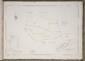
| 18 | Curraheen | An Curraichín | Ross | East Carbery (West Division) | East Carbery (West Division) | 87 a 1 r 6 p | 85 a 3 r 5 p |
Meaule
| 18 | Maul | An Mhaoil | Ross | East Carbery (West Division) | East Carbery (West Division) | 114 a 3 r 0 p | 114 a 2 r 35 p |
Ballyvireen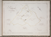
| 19 | Ballyvireen | Baile Uí Mhirín | Ross | West Carbery (East Division) | East Carbery (West Division) | 287 a 1 r 20 p | 287 a 0 r 36 p |
Creg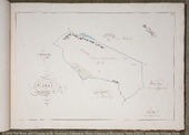
| 20 | Cregg | An Chreag | Kilfaughnabeg | West Carbery (East Division) | East Carbery (West Division) | 191 a 3 r 35 p | 187 a 0 r 15 p |
Borough of
Baltimore
| 21 | Baltimore | Dún na Séad | Ross | West Carbery (East Division) | West Carbery (East Division) | 575 a 2 r 34 p | 636 a 1 r 33 p |
Baltimore
Reference
| Reference for Baltimore | Baltimore | Dún na Séad | Ross | West Carbery (East Division) | West Carbery (East Division) | ||
Ballylinchey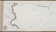
| 22 | Ballylinchy | Baile Uí Loingseacháin | Tullagh | West Carbery (East Division) | West Carbery (East Division) | 781 a 0 r 6 p | 811 a 2 r 39 p |
Ballymacrown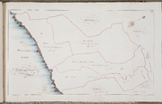
| 23 | Ballymacrown | Baile Mhic Eiriúin | Tullagh | West Carbery (East Division) | West Carbery (East Division) | 637 a 3 r 9 p | 669 a 2 r 30 p |
Rathmore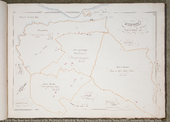
| 24 | Rathmore | An Ráth Mhór | Tullagh | West Carbery (East Division) | West Carbery (East Division) | 708 a 3 r 18 p | 713 a 0 r 24 p |
Lackahane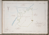
| 25 | Lackaghane | Leacachán | Creagh | West Carbery (East Division) | West Carbery (East Division) | 190 a 3 r 25 p | 182 a 1 r 26 p |
Bally Island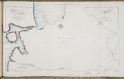
| 26 | Ballyisland | Baile an Oileáin | Creagh | West Carbery (East Division) | West Carbery (East Division) | 823 a 0 r 0 p | {107 a 1 r 5 p |
(Part of
Bally Island)
| 26 | Ballyoughtera | An Baile Uachtarach | Creagh | West Carbery (East Division) | West Carbery (East Division) | - | {156 a 1 r 26 p |
(Part of
Bally Island)
| 26 | Lahernathee | Leathfhearann an Tí | Creagh | West Carbery (East Division) | West Carbery (East Division) | - | {121 a 1 r 10 p |
(Part of
Bally Island)
| 26 | Curravally | An Corrbhaile | Creagh | West Carbery (East Division) | West Carbery (East Division) | - | {106 a 0 r 21 p |
(Part of
Bally Island)
| 26 | Ballyally | Baile Uí Áille | Creagh | West Carbery (East Division) | West Carbery (East Division) | - | {198 a 3 r 38 p |
(Part of
Bally Island)
| 26 | Drumadoon | Drom an Dúin | Creagh | West Carbery (East Division) | West Carbery (East Division) | - | {139 a 2 r 34 p |
Clodough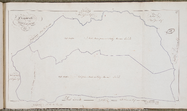
| 27 | Clodagh | An Cladach | Dromdaleague | West Carbery (East Division) | West Carbery (East Division) | 1026 a 0 r 33 p | 1048 a 0 r 10 p |
Mohenaugh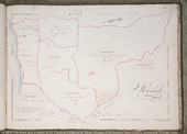
| 28 | Mohenagh | An Mhúchánach | (Abbeystrowry) Aghadown | West Carbery (West Division) | West Carbery (East Division) | 662 a 2 r 5 p | 675 a 3 r 29 p |
Rathine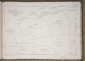
| 29 | Rahine | Ráth Choinn | Aghadown | West Carbery (West Division) | West Carbery (East Division) | 157 a 3 r 20 p | 156 a 2 r 38 p |
Fohurlagh
| 29 | Fotherlagh | Fotharlach | Aghadown | West Carbery (West Division) | West Carbery (East Division) | 210 a 1 r 16 p | 211 a 2 r 14 p |
Towermore
| 29 | Toormore | An Tuar Mór | Aghadown | West Carbery (West Division) | West Carbery (East Division) | 140 a 3 r 0 p | 142 a 1 r 38 p |
Knocknamahallagh
| 29 | Knocknamohalagh | Cnoc na mBathlach | Aghadown | West Carbery (West Division) | West Carbery (East Division) | 129 a 0 r 0 p | {92 a 1 r 10 p |
(Part of
Knocknamahallagh)
| 29 | Gneeves | Na Gníomha | Aghadown | West Carbery (West Division) | West Carbery (East Division) | - | {38 a 1 r 5 p |
Coolbaune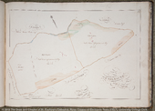
| 30 | Coolbane | An Chúil Bhán | Caheragh | West Carbery (West Division) | West Carbery (West Division) | 470 a 2 r 11 p | 518 a 3 r 27 p |
Ballycomaune
| 31 | Ballycomane | Baile Uí Chomáin | Durrus | West Carbery (West Division) | West Carbery (West Division) | 1315 a 0 r 29 p | 1350 a 2 r 13 p |
Sir Mount
Domain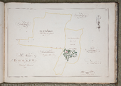
| 32 (Part of
modern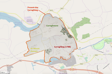 Curraghbeg) Curraghbeg) | — | - | Athnowen | Muskerry | East Muskerry | {298 a 0 r 38 p | - |
Curraghbeg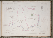
|
33 (Part of
modern Curraghbeg)
| Curraghbeg | An Chora Bheag | Athnowen | Muskerry | East Muskerry | {367 a 1 r 17 p | 1073 a 4 r 33 p |
Curraghmore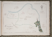
|
34 (Part of
modern Curraghbeg)
| — | An Chora Mhór | Athnowen | Muskerry | East Muskerry | {414 a 2 r 33 p | - |
Castle Inch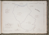
| 35 | Castleinch | Caisleán na hInse | Athnowen | Muskerry | East Muskerry | 376 a 0 r 8 p | 371 a 1 r 13 p |
Ballynamernagh
alias Walshestown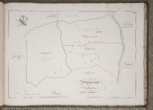
| 36 | Walshestown | Baile na mBreatnach | Athnowen | Muskerry | East Muskerry | 304 a 0 r 39 p | 303 a 1 r 6 p |
Mullaghroe
| 36 | Mullaghroe | An Mullach Rua | Athnowen | Muskerry | East Muskerry | 204 a 2 r 33 p | 204 a 1 r 29 p |
Lackinirage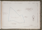
| 37 | Lackenareague | An Leaca Réidh | Athnowen | Muskerry | East Muskerry | 190 a 1 r 10 p | 188 a 3 r 8 p |
* Map 10, entitled Woodfield, contains four distinct townlands: Woodfield, Paulbeg, Ballyvackey and Gorralocka. The first three of these combined together accurately match the border of present-day Woodfield, while Gorralocka’s perimeter barely deviates from that of Garralacka today. The townland bordering Gorralocka and Ballyvackey to the east of the Freke lands in Map 10 is also called Ballyvackey, which is the name of the townland bordering present-day Woodfield and Garralacka to the east. Among the townlands listed in Petty’s 1659 ‘census’ of Ireland in the civil parish of ‘Keilkerawnemore’ (now Kilkerranmore) are ‘Ballyvackimore’, ‘Ballyvackybegg’ and ‘Garrylucky’. The acreage of modern Ballyvackey is 294 acres while that of the second Ballyvackey within the 1788 Freke estate is 190 acres. This suggests that the larger modern Ballyvackey corresponds to Ballyvackimore (Baile an Bhacaigh Mór) and the smaller Freke-owned Ballyvackey corresponds to Ballyvackybegg (Baile an Bhacaigh Beag).
Table 2: Named tenants and their holdings
| Townland name recorded in Freke Estate Survey | Map | Tenant(s) | Area of tenant holding |
|---|---|---|---|
| Carrigfadeen |
4
| Hurley and Crimeen | 69 a 3 r 0 p |
| Carrigfadeen |
4
| Daniel Donovan | 31 a 2 r 4 p |
| Carrigfadeen |
4
| Daniel Connolly | 51 a 1 r 22 p |
| Woodfield |
10
| Denis Hayes | 169 a 3 r 8 p |
| Paulbeg |
10
| Darby & Pat Sheehy | 118 a 2 r 14 p |
| Paulbeg |
10
| John Collins | 122 a 2 r 18 p |
| Ballyvackey |
10
| Denis Carthy | 50 a 0 r 15 p |
| Ballyvackey |
10
| John Bateman | 140 a 3 r 0 p |
| Gorralocka |
10
| Timothy Carthy | 233 a 0 r 13 p |
| Maullicorcoran |
11
| Widow Cambridge | 44 a 0 r 16 p |
| Maullicorcoran |
11
| Peter Cusack | 91 a 3 r 3 p |
| Coolcraheen |
13
| William Wolfe | 118 a 1 r 26 p |
| Coolcraheen |
13
| John Wolfe | 90 a 1 r 24 p |
| Coolcraheen |
13
| Samuel Wright | 79 a 1 r 4 p |
| Bohenaughts |
16
| Hea’s land | 110 a 2 r 22 p |
| Bohenaughts |
16
| Priest’s land | 69 a 1 r 0 p |
| Bohenaughts |
16
| Toombrock | 74 a 0 r 6 p |
| Bohenaughts |
16
| Crowley’s Division | 113 a 2 r 30 p |
| Curragheen |
18
| Owen Harrington | 9 a 1 r 14 p |
| Curragheen |
18
| John Hungerford | 3 a 3 r 28 p |
| Curragheen |
18
| John Hungerford | 8 a 0 r 38 p |
| Curragheen |
18
| Long | 3 a 1 r 19 p |
| Curragheen |
18
| Coveny | 5 a 1 r 35 p |
| Ballyvireen |
19
| Widow O’Hea | 108 a 0 r 36 p |
| Ballyvireen |
19
| Widow O’Hea’s Mill-holding | 21 a 0 r 21 p |
| Ballyvireen |
19
| Daniel O’Donovan | 110 a 2 r 0 p |
| Rathmore |
24
| Gortcathleen | 186 a 0 r 0 p |
| Rathmore |
24
| Lahernavedoragh* or Weaver’s Land | 132 a 3 r 8 p |
| Rathmore |
24
| Berry’s Division | 134 a 0 r 10 p |
* The dual naming indicates that the original Irish placename is Leathfhearann na bhFíodórach: fíodórach is an old genitive singular form of fíodóir/figheadóir, a weaver, see edil, headword 22047. Caora has the same genitive singular and plural form caorach as illustrated in the placename Gleann na gCaorach (Glenageary). This suggests that fíodórach is likewise both a genitive singular and plural form of fíodóir.
Table 3: Reference for Town of Old Ross
(Up/Down arrows point to combined acreage of multiple lots with shared garden)
| Street | No. | Occupier | Dwelling Type | a | r | p |
|---|---|---|---|---|---|---|
| Main Street North Side | 1 | Matthew Mahony | House | 0 | 0 | 31 |
| " " " " | 2 | Widow Brien | House | ↑ | ||
| " " " " | 3 | John Hungerford | new Slate House | 0 | 0 | 38 |
| " " " " | 4 | John Brien | House and Yard | ↑ | ||
| " " " " | 5 | William Gash | House & back House | ↓ | ||
| " " " " | 6 | John Coosheen | House | 0 | 1 | 19 |
| " " " " | 7 | Thos. Tobin | Slate House | ↑ | ||
| " " " " | 8 | John Barry | Slate House | ↓ | ||
| " " " " | 9 | Edwd. Williamson | Slate House | 0 | 1 | 2 |
| " " " " | 10 | Timmy Dawley | Slate House | ↑ | ||
| " " " " | 11 | Andrew Donahoe | Slate House | 0 | 1 | 37 |
| " " " " | 12 | Florence Donahoe | Slate House | ↑ | ||
| " " " " | 13 | James Tobin | House, back House & Garden | 0 | 0 | 34 |
| " " " " | 14 | John Lee | House, back House & Garden | 0 | 0 | 17 |
| " " " " | 15 | Widow Galway | Warehouse | ↓ | ||
| " " " " | 16 | Widow Galway | Dwelling House, Yard & Garden | 0 | 1 | 0 |
| " " " " | 17 | In hands | Waste | ↓ | ||
| Front to Fair Green West Side | 18 | Daniel Clancy | a Cabbin | ↓ | ||
| " " " " | 19 | Widow Driscoll | a Cabbin | ↓ | ||
| " " " " | 20 | Mathew Higgins | two Cabbins | 0 | 0 | 12 |
| " " " " | 21 | " " | " " | ↑ | ||
| " " " " | 22 | William Hayes | a Cabbin | ↑ | ||
| Fair Green East Side | 23 | John Roe | a Cabbin | ↓ | ||
| " " " " | 24 | Dennis Donovan | a Cabbin | ↓ | ||
| " " " " | 25 | Late John Miles | a Cabbin | ↓ | ||
| " " " " | 26 | Timothy Lahy | three Cabbins | ↓ | ||
| " " " " | 27 | " " | " " | ↓ | ||
| " " " " | 28 | " " | " " | ↓ | ||
| Main Street North Side | 29 | Widow Hurley | a Cabbin | 0 | 3 | 17 |
| " " " " | 30 | James Hamilton | " " | ↑ | ||
| " " " " | 31 | Daniel Driscoll | " " | ↑ | ||
| " " " " | 32 | Daniel Harrington | " " | ↑ | ||
| " " " " | 33 | Bartholomew Brien | " " | ↑ | ||
| " " " " | 34 | Daniel Dillon | " " | ↑ | ||
| " " " " | 35 | John Donahoe | " " | ↑ | ||
| " " " " | 36 | Revd O'Brien | " " | ↑ | ||
| " " " " | 37 | Sylvester Hurley | House | 0 | 2 | 0 |
| " " " " | 38 | Timothy Collins | House | ↑ | ||
| " " " " | 39 | Patrick Lovejoy | Potatoe Garden, N. side Road to CastleFreke | 2 | 3 | 11 |
| " " " " | 40 | Several Cabbins & rocky Waste | Held in common | 1 | 2 | 23 |
| " " " " | 41 | Richard Smith | the Paddock, S. Side of CastleFreke | 3 | 3 | 12 |
| " " " " | 42 | Timothy Dillon | the Marsh | 2 | 1 | 25 |
| " " " " | 43 | The Pound, Fair green &c | 1 | 3 | 25 | |
| North side of Fair Green | 44 | Timothy Hayes | Garden Arable | 1 | 2 | 0 |
| North side Road to Skibereen | 45 | Several Cabbins & rocky Waste | Held as Common | 2 | 0 | 0 |
| " " " " | 46 | Francis Dillon | a Cabbin | ↓ | ||
| " " " " | 47 | Widow Downes | a Cabbin | ↓ | ||
| " " " " | 48 | Francis Dillon | Forge | ↓ | ||
| " " " " | 49 | " " | a Cabbin | ↓ | ||
| " " " " | 50 | Florence Sullivan | two Cabbins | 0 | 0 | 15 |
| " " " " | 51 | John Sullivan | a Cabbin | ↑ | ||
| " " " " | 52 | Dennis Sullivan | " " | ↑ | ||
| " " " " | 53 | John Carthy | " " | ↑ | ||
| " " " " | 54 | Timothy Carthy | " " | ↑ | ||
| " " " " | 55 | " " | Garden Arable | 1 | 1 | 36 |
| Main Street south Side | 1 | Richard Smith | Dwelling House, Yard, Offices, | 2 | 3 | 27 |
| " " " " | 1 | Richard Smith | Malt House, Garden & Orchard | ↑ | ||
| " " " " | 2 | Sylvester Hurley | a Cabbin | ↓ | ||
| " " " " | 3 | Darby Coghlan | " " | 0 | 0 | 3 |
| " " " " | 4 | Daniel Keefe | " " | ↑ | ||
| " " " " | 5 | John Ferrall | " " | ↓ | ||
| " " " " | 6 | Thomas Driscoll | " " | ↓ | ||
| " " " " | 7 | Mary O'Brien | " " | ↓ | ||
| " " " " | 8 | Patrick Lovejoy | " " | ↓ | ||
| " " " " | 9 | James Collins | " " | ↓ | ||
| " " " " | 10 | Owen Harrington | " " | 0 | 2 | 3 |
| " " " " | 11 | William Driscoll | " " | ↑ | ||
| " " " " | 12 | Edwd Scanlon or Donahoe | in Ruin | ↑ | ||
| " " " " | 13 | John Hamilton | a Cabbin | ↑ | ||
| " " " " | 14 | Darby Canty | " " | ↑ | ||
| " " " " | 15 | John McNede | " " | ↑ | ||
| " " " " | 16 | Dennis Regan | " " | ↑ | ||
| " " " " | 17 | James Brooke | " " | ↓ | ||
| " " " " | 18 | Daniel Hamilton | " " | ↓ | ||
| " " " " | 19 | Jeremiah Donovan | " " | ↓ | ||
| " " " " | 20 | Widow Collins | " " | ↓ | ||
| " " " " | 21 | Daniel Brien | " " | ↓ | ||
| " " " " | 22 | John Mahony & Denis Donovan | " " | ↓ | ||
| " " " " | 23 | Denis Herlahy | " " | ↓ | ||
| " " " " | 24 | Edwd FitzGerald | " " | 0 | 2 | 26 |
| " " " " | 25 | Cornelius Collins | " " | ↑ | ||
| " " " " | 26 | Widow Galway | " " | ↑ | ||
| " " " " | 27 | Peter Hurley | " " | ↑ | ||
| " " " " | 28 | Dennis Donovan | " " | ↑ | ||
| " " " " | 29 | Daniel Mahony | House | ↑ | ||
| " " " " | 30 | Richard Long | " " | ↑ | ||
| " " " " | 31 | Jeremiah Shanahane | " " | ↑ | ||
| Market Place South side | 1 | Timothy Hayes | House | ↓ | ||
| " " " " | 2 | Dennis Donovan | " | ↓ | ||
| " " " " | 3 | John Henessy | House & back House | ↓ | ||
| " " " " | 4 | Francis Donovan | " " " | ↓ | ||
| " " " " | 5 | William Donovan | " " " | ↓ | ||
| " " " " | 6 | Daniel Donovan(Island) | new Slate House | ↓ | ||
| " " " " | 7 | Stephen Legoe | House | ↓ | ||
| " " " " | 8 | Widow Dugan | Slate House | 0 | 3 | 32 |
| " " " " | 9 | Widow Danger | Slate House | ↑ | ||
| " " " " | 10 | Widow Dawley | a House | ↑ | ||
| " " " " | 11 | John Harrington | " " | ↑ | ||
| " " " " | 12 | Cornelius Donovan | " " | ↑ | ||
| Barrack Lane East side | 13 | Formerly Daniel Harrington | Waste | ↑ | ||
| " " " " | 14 | Darby Spillane | a Cabbin | ↑ | ||
| " " " " | 15 | Dennis ?ouloo | " " | ↑ | ||
| " " " " | 16 | John O'Brien | " " | ↑ | ||
| " " " " | 17 | James Bennett | four Cabbins & Garden | 0 | 0 | 18 |
| Barrack Lane West side | 18 | Edward Pursell | five Cabbins & Yards | 0 | 0 | 11 |
| " " " " | 19 | Several Cabbins in Ruin | ↓ | |||
| Tanyard Lane South side | 20 | Melachy | a Cabbin | ↓ | ||
| " " " " | 21 | Dennis Mohony | " " | 0 | 2 | 26 |
| " " " " | 22 | Widow Collins | " " | ↑ | ||
| " " " " | 23 | Widow Sullivan | " " | ↑ | ||
| " " " " | 24 | Dennis Munnick | " " | ↑ | ||
| " " " " | 25 | John Galway (late) | Field Arable & Malt House | 0 | 3 | 16 |
| " " " " | 26 | John Hungerford | Orchard | 0 | 3 | 32 |
| " " " " | 27 | Formerly John Galway | Field | 2 | 0 | 21 |
| " " " " | 28 | Rocky Pasture | in Common | 1 | 0 | 35 |
| Tanyard Lane North side | 29 | Late J. Galway | Tan Yard &c | 0 | 0 | 36 |
| " " " " | 30 | Darby Carthy | House and Bleach Green | 0 | 2 | 38 |
| " " " " | 31 | Stephen Galway | Field | 1 | 3 | 4 |
| " " " " | 32 | Maurice Coosheen | Cabbin and Yard | 0 | 0 | 31 |
| " " " " | 33 | Charles Collins | " " " | ↑ | ||
| Tanyard Lane | 34 | Daniel Donovan or Blackstaff | a Cabbin | ↓ | ||
| " " " " | 35 | Waste | ↓ | |||
| " " " " | 36 | John Donovan | a Cabbin | ↓ | ||
| " " " " | 37 | Darby Donovan | " " | ↓ | ||
| " " " " | 38 | Michael Carthy | " " | 0 | 1 | 8 |
| " " " " | 39 | Charles Dempsy | House | ↑ | ||
| " " " " | 40 | Widow Lane | " | ↑ | ||
| " " " " | 41 | Widow Dillon | " | ↑ | ||
| " " " " | 42 | Widow Long | " | ↑ | ||
| " " " " | 43 | Stephen Galway | Slate House, Yard and Garden | 0 | 0 | 36 |
| " " " " | 44 | Peter Carthy | House, back House and Garden | ↓ | ||
| " " " " | 45 | Waste | ↓ | |||
| " " " " | 46 | John Carthy | Cabbin | ↓ | ||
| " " " " | 47 | Catherine Sullivan | " | 0 | 0 | 28 |
| " " " " | 48 | John Scanlon | " | ↑ | ||
| " " " " | 49 | John Collins | " | ↑ | ||
| " " " " | 50 | John Scanlon | " | ↑ | ||
| " " " " | 51 | Timothy Harrington | 0 | 0 | 22 | |
| " " " " | 52 | Owen Harrington | ↑ | |||
| Church Lane North side | 1 | Widow Smith | new Slate House and Garden | 0 | 0 | 25 |
| " " " " | 2 | Widow Kelly | a House | ↓ | ||
| " " " " | 3 | Richard Carney | a House | ↓ | ||
| " " " " | 4 | Michael Regan from T.Hayes | House | 0 | 1 | 10 |
| " " " " | 5 | Widow Regan | Slate House | ↑ | ||
| " " " " | 6 | John Hayes | ↑ | |||
| " " " " | 7 | Cornelius Burke | Cabbin | ↓ | ||
| " " " " | 8 | Martin Regan | 0 | 0 | 24 | |
| " " " " | 9 | James Feehely | ↑ | |||
| " " " " | 10 | John Collins | ↑ | |||
| " " " " | 11 | Darby Dawley | two Cabbins | ↓ | ||
| " " " " | 12 | " " | " " | 0 | 0 | 32 |
| " " " " | 13 | Darby Dempsey | House and back House | ↑ | ||
| " " " " | 14 | Henry Dineen | House | ↑ | ||
| " " " " | 15 | John Brien or Mungan | House and Garden formerly Slopyard | 0 | 2 | 15 |
| " " " " | 16 | Daniel Hayes | House and Garden | 0 | 3 | 33 |
| " " " " | 17 | Widow Munroe | Cabbin and Garden | 0 | 0 | 8 |
| " " " " | 18 | John Legoe | House and Orchard | 0 | 2 | 30 |
| " " " " | 19 | " " | Field, Pasture | 1 | 1 | 12 |
Table 4: Reference for Borough of Baltimore
| No. | Occupier | a | r | p |
|---|---|---|---|---|
| 1 | The Castle, Rocks and Waste | 0 | 2 | 6 |
| 2 | Dennis Driscoll | 0 | 1 | 15 |
| 3 | Charles Davis | 0 | 1 | 36 |
| 4 | James Meldrum | 0 | 2 | 22 |
| 5 | Four Cabbins and Waste | 0 | 1 | 13 |
| 6 | Cabbins and Garden | 0 | 1 | 17 |
| 7 | Cabbins and Garden | 0 | 0 | 21 |
| 8 | Archibald Molloy | 0 | 2 | 9 |
| 9 | James Freke | 1 | 2 | 29 |
| 10 | Florence and Mary Driscoll | 0 | 2 | 36 |
| 11 | Richard Baker | 0 | 3 | 16 |
| 12 | Thomas Byers | 0 | 3 | 13 |
| 13 | Francis Bush | 3 | 1 | 17 |
| 14 | James Freke | 0 | 2 | 13 |
| 15 | Darby Fowler | 0 | 2 | 22 |
| 16 | James Freke | 0 | 3 | 0 |
| 17 | John Crowley | 0 | 2 | 32 |
| 18 | Jeremiah Lynch | 2 | 1 | 38 |
| 19 | Widow Ahern | 1 | 0 | 22 |
| 20 | Richard Bush | 0 | 1 | 21 |
| 21 | Henry Bush | 0 | 2 | 22 |
| 22 | Dan Harrington | 0 | 1 | 35 |
| 23 | Denis Harrington | 1 | 0 | 19 |
| 24 | Richard Bush, Coney Island | 19 | 2 | 0 |
| 25 | Henry Bush, Harbour's Mouth | 46 | 1 | 12 |
| 26 | Thomas Roche and Richard Bush, Hill of Baltimore | 236 | 2 | 12 |
| 27 | Jeremiah Lynch | 6 | 2 | 22 |
| 28 | John Neale | 2 | 0 | 0 |
| 29 | Widow Baker | 8 | 0 | 24 |
| 30 | James Freke | 74 | 0 | 20 |
| 31 | James Freke, Lahern or Cloghboaley | 92 | 1 | 5 |
| 32 | Richard Bush, Francis Bush and Partners, Gerrynane | 70 | 1 | 25 |
Table 5: Adjacent lands (not belonging to the Freke Estate) and their owners
| Map | Name | Owner | Name | Owner | Name | Owner | Name | Owner |
|---|---|---|---|---|---|---|---|---|
2
| Dondedy | Sir Edward Barry | ||||||
3
| Kilkerran | Sir Edward Barry | Dondedy | Sir Edward Barry | ||||
4
| Carrigroe | James Bernard Esq. | Kilkerran | Sir Edward Barry | Garranecore | See of Cork & Ross | ||
5
| Aughaglaslin | John O’Hea Esq. | ||||||
6
| Burrigashee | See of Cork & Ross | Aughaglaslin | John O’Hea Esq. | ||||
7
| Aughaglaslin | John O’Hea Esq. | ||||||
8
| Farrencantree | See of Cork & Ross | Garranecore | See of Cork & Ross | ||||
9
| Garrigeen Deer Park | John Bernard Esq. | Ballyluge | Hon. John Smith Barry | Ballymacreddan | James Bernard Esq. | Thravarra | (shoreline) |
| Thrashorsheen | (shoreline) | |||||||
10
| Knockfeen | Thomas Hungerford Esq. | Coorcraheen | Thomas Hungerford Esq. | Coolnageagh | Thomas Hungerford Esq. | Corleagh | John Howe Esq. |
| Aughagiley | Charles Allen Esq. | Ballyvackey | Charles Allen Esq. | Ballydivane | Thomas Allen Esq. | Curragh | James Bernard Esq. | |
| Tullyneskee | Miss Jermyn | |||||||
11
| Creighbeg | James Bernard Esq. | Creighmore | James Bernard Esq. | Tullyneskea | Miss Jermyn | ||
12
| Drough | Arthur Lemial Shuldham Esq. | Shanagrane | Gilbert Mellefont Esq. | Togher | Hoare Esq. | Incherea | Henry Cox Esq. |
| Durrincorra | Henry Cox Esq. | |||||||
13
| Knockfeen | Thomas Hungerford Esq. | Tullneskea | Miss Jermyn | Derryduff | James Bernard Esq. | ||
14
| Keeleagh | Thomas Hungerford Esq. | Knockfeen | Thomas Hungerford Esq. | Derryduff | James Bernard Esq. | Cahirmore | See of Cork & Ross |
15
| Derryduff | James Bernard Esq. | Farrencantree | See of Cork & Ross | Cahirmore | See of Cork & Ross | ||
16
| Farrencantree | See of Cork & Ross | Aughaglasslin | See of Cork & Ross | Burgeshee | See of Cork & Ross | Cahirmore | See of Cork & Ross |
17
| Ardagh | Lord Riversdale | Downeene | See of Cork & Ross | English Island | Lord Riversdale | ||
18
| Ardagh | See of Dublin | Doneen | See of Cork & Ross | Gullane | St. Ledger Atkins Esq. | Derry | Thomas Townsend Esq. |
19
| Derry | Thomas Townsend Esq. | Gullane | See of Cork & Ross | Ballynaclogh | Daniel O’Regan Esq. | Killeenleagh | Dan O’Regan Esq., Beecher Esq. |
| Thralong | Workman Esq. | Drombeg | - | |||||
20
| Drombeg | - | Thralong | Workman Esq. | Brew-lea | Fitzgerald Esq. | Carrigluska | Dunbar Esq. |
21
| Thrafraskey or Bruce Cove | (shoreline) | Church Strand | (shoreline) | ||||
22
| Kedge Island | (island) | Bruce Cove | (shoreline) | Church Strand Bay | (shoreline) | ||
23
| Ardagh | William Wrixon Esq. | Barnaboe | William Wrixon Esq. | Ballynard | Morgan Donovan Esq. | ||
24
| High-Field | St Ledger Atkins Esq. | Ardagh | William Wrixon Esq. | ||||
25
| Innesbeg | See of Cork and Ross | Cree | William Wrixon Esq. | ||||
26
| Drishanemore | Richard Boyle Townsend Esq. | Boaleybaune | Richard Boyle Townsend Esq. | Lick | St. Ledger Atkins Esq. | Munnick | William Wrixon Esq. |
| Pookeen | William Wrixon Esq. | Lough Ine | (marine lake) | Bullock Island | (island) | |||
27
| Kaunkillish | Samuel Jervois Esq. | Letra | Samuel Jervois Esq. | Pookeen | Timothy Deasey Esq. | Acres | Richard O'Donovan Esq. |
| Lougherut | Rt. Hon. Lord Riversdale | Derrygruagh | James Kingston Esq. | Stronacarton | Rt. Hon. Lord Riversdale | |||
28
| New Court | Richard Beecher Esq. | Tavermore | - | Barnagowlaune | Edwd Townsend Esq. | Lissanebeg | Richard Boyle Townsend Esq. |
| Abbey | Beecher Esq. | Rossnagoose | Rt. Hon. Lord Riversdale | |||||
29
| Knockeen | Richard Beecher Esq. | Munnane | Richard Beecher Esq. | Prohoonus | Richard Beecher Esq. | Lyre | Richard Beecher Esq. |
| Skai | Richard Boyle Townsend Esq. | Baarnagowlaune | Edward Townsend Esq. | Knockgorum | Richard Beecher Esq. | Renmurragha | Richard Beecher Esq. | |
| Gurteenrugh | Richard Beecher Esq. | Litterscanlaght | Richard Beecher Esq. | |||||
30
| Currane | William Wrixon Beecher Esq. | Clahane | Newman Esq. | Kielnageeshough | Richard Beecher Esq. | Skai | Richard Boyle Townsend Esq. |
| Cooraneller | Richard Beecher Esq. | |||||||
31
| Carrigbuoy | James Bernard Esq. | Dromtineheen | James Bernard Esq. | Cruttee | James Bernard Esq. | West Clonee | Arthur Hyde Esq. |
| Clonee | Hugh Hutchinson Esq. | Knowlavard | Hugh Hutchinson Esq. | Glenlough | Hugh Hutchinson Esq. | Kielreagh | Rt. Hon. Lord Riversdale | |
| Dromreagh | Rt. Hon. Lord Riversdale | |||||||
32
| Knockaunemore | Sir John Miller | ||||||
33
| Knockaunemore | Sir John Miller | Glebe of Inniscarra | Clashes | Col. John Walsh | Barnagrove | Hon. Judge Bennet | |
34
| Curraghglee | Bryan Sheehy Esq. | Corrigeen | Sir Nicholas Colthurst | Glebe of Inniscarra | |||
35
| Foghagh | James Chatterton Esq. | Curraghglee | Bryan Sheehy Esq. | Glebe of Inniscarra | |||
36
| Clashenure | Rev. John Meade | Ennislinghey | Duke of Devonshire | Foghagh | James Chatterton Esq. | ||
37
| Clashenure | Rev. John Meade | Knockaunemore | Sir John Miller |
Table 6: Lettings advertised on behalf of Sir John Freke in the Cork Evening Post, 31/8/1786
"To be LET from next November for such term of Lives or Years as may be agreed on, the following Parts of the Estate of Sir John Freke, Bart."
| 1786 acreage | 1787/88 acreage | ||||||
|---|---|---|---|---|---|---|---|
| A. | R. | P. | A. | R. | P. | ||
| 3 | Plowlands of Ballyisland | 849 | 0 | 29 | 823 | 0 | 0 |
| 3 | Plowlands of Ballmacrowne | 641 | 3 | 35 | 637 | 3 | 9 |
| 3 | Plowlands of Ballcomane | 1367 | 3 | 13 | 1315 | 0 | 29 |
| 3 | Plowlands of Baltimore | 561 | 0 | 16 | 575 | 2 | 34 |
| 1 ⅓ | Plowland of Keenrath | 577 | 0 | 4 | 417 | 1 | 8 |
| 15 | Gneeves of Cluddagh | 992 | 3 | 8 | 1026 | 0 | 33 |
| 2 | Plowlands of Bohennagh | 371 | 1 | 12 | 367 | 2 | 18 |
| 1½ | Plowland of Ballyvireen | 282 | 1 | 22 | 287 | 1 | 20 |
| 1 | Plowland of Meaul and Curraheen1 | 193 | 0 | 12 | 202 | 0 | 6 |
| 9 | Gneeves of Coulbane | 333 | 2 | 13 | 470 | 2 | 11 |
| ½ | Plowland of Ballywholahane | 80 | 0 | 6 | 77 | 2 | 3 |
| 3 | Plowlands of Ballylinsheen | 761 | 1 | 29 | 781 | 0 | 6 |
| 2 | Plowlands of Woodfield2 | 837 | 2 | 36 | 834 | 3 | 28 |
| 1 | Plowland of Garrane and Lissard1 | 219 | 0 | 13 | 219 | 3 | 5 |
| 2 | Plowlands of Rathine3 | 662 | 2 | 7 | 637 | 3 | 36 |
| 1 | Plowland of Lackahane | 196 | 1 | 28 | 190 | 3 | 25 |
"These lands, except for Keenrath and Cluddagh, are in Sir John Freke’;s manors of Cloghane, Ballinava, Gortnahona, Kilfinnin, Rinco? and Baltimore, are contiguous to the towns of Ross, Skibbereen and Baltimore and are good Pasture and Tillage."
Notes on lettings in the barony of Carbery:
- The two townlands of Meaule and Curragheen (see Table 1) have a combined acreage of 114a 3r 0p + 87a 1r 6p = 202a 0r 6p. Similarly, the combined acreage of Garrane and Lissard is 219a 3r 5p.
- See Table 1 footnote relating to Map 10/Woodfield. The combined acreage of Map 10 is 834a 3r 28p which strongly suggests that all four townlands in Map 10 are included in this proposed letting. Note that while these lands are counted among those in the barony of Carbery in this 1786 advertisement, they are listed under Ibaune and Barryroe in the 1787/88 survey and this remains the case today. Ibaune and Barryroe also appears in the record (Irish Records Commission, Reports 1821-25, p.393) of the Freke Purchase in 1703 of these lands - then known as Derrylone/Derryloone from the Irish Doire Luain - following their confiscation from David Barry who took the Jacobite side in the Williamite wars. It is noteworthy, however, that in three Memorial Deeds of Lease from the years 1721, 1729 and 1742 (Registry of Deeds Nos. 39847, 41805, 74429) these lands are described as being in the barony of East Carbery, consistent with this advertisement.
- Map 29 is entitled 'Rathine, etc.' and includes the townlands of Rathine, Fohurlagh, Towermore and Knocknamahallagh. Their combined acreage is 637a 3r 36p which strongly suggests that all four townlands are included in this proposed letting.
| 1786 acreage | 1787/88 acreage | ||||||
|---|---|---|---|---|---|---|---|
| A. | R. | P. | A. | R. | P. | ||
| 1 | Plowland of Milltown | 101 | 0 | 16 | 103 | 3 | 32 |
| 1 | Plowland of Gortegrenane | 178 | 2 | 0 | 119 | 0 | 20 |
| 2 | Plowlands of Rathbarry1 | 304 | 0 | 6 | 325 | 2 | 5 |
| ½ | Plowland of Croghnah?2 | 71 | 0 | 0 | - | - | - |
| 1 | Plowland of Ballymaishoneen? | 231 | 2 | 1 | 235 | 0 | 5 |
| 1 | Plowland of Carrigfadeen | 177 | 1 | 0 | 152 | 2 | 26 |
| 1 | Plowland of Knocknageehe | 252 | 2 | 0 | 247 | 0 | 39 |
| ½ | Plowland of Knocknagapol | 100 | 0 | 0 | 102 | 1 | 0 |
| ½ | Plowland of Maulatrahane | 39 | 1 | 6 | 65 | 0 | 0 |
| 5 | Gneeves of Maullicorcorane | 131 | 0 | 33 | 135 | 3 | 19 |
| ½ | Plowland of Little Island | 90 | 0 | 0 | 118 | 3 | 5 |
| Mill and Holding of Newmill2 | 17 | 1 | 0 | - | - | - | |
"These Lands are most excellent tillage, and pasture, and meadow."
Notes on lettings in the barony of Barryroe and Ibawne:
- Due to their similar acreage, it is assumed that this is Castlefreke townland, which was formerly known as Rathbarry and whose Irish form is Ráth an Bharraigh.
-
These names cannot be identified among those in the survey.
A question mark indicates uncertainty in the spelling due to poor reproduction quality of the CEP advertisement.
| 1786 acreage | 1787/88 acreage | ||||||
|---|---|---|---|---|---|---|---|
| A. | R. | P. | A. | R. | P. | ||
| ½ | Plowland of Curraghbeg | 189 | 1 | 10 | 3671 | 1 | 17 |
| ½ | Plowland of Lackareige | 190 | 1 | 10 | 190 | 1 | 10 |
"These lands are part of the Estate of Sirmount or Castlehinchy and are within seven miles of Cork."
Notes on lettings in the barony of Muskerry:
-
In the 1787/88 survey, Curraghbeg is divided into an East Division of acreage 190a 2r 35p and a West Division of acreage 171a 0r 34p, hence the proposed letting may have referred to the East Division only.
"Proposals in writing will be received by Sir John Freke, Bart, Percy Lodge, near Enniscorthy. Every Encouragement will be given to resident, solvent and improving tenants, and no notice will be taken of any application from persons, who will not reside or hold the Farms in their own hands."
"Also to hold on binding? Leases, the greater part of the Town of Ross and Sword Parks* adjoining it; manufacturers in every Branch, will meet? the utmost encouragement: apply as above. Aug 28th."
* This unusual term may be an anglicised version of Fearann claidhimh, sword-land, conquered territory. (Seán Ó Coileáin, priv. comm.)
Document details
The TEI Header
File description
Title statement
Title (uniform): Freke Estate (Cork) Survey of 1787/88
Author: Thomas Sherrard
Responsibility statement
Electronic edition compiled and proof-read by: Pádraig Mac Cárthaigh
Funded by: School of History, University College, Cork
Edition statement
1. First draft, revised and corrected
Extent: 8640 words
Publication statement
Publisher: CELT: Corpus of Electronic Texts: a project of University College, Cork
Address: College Road, Cork, Ireland—http://www.ucc.ie/celt
Date: 2019
Distributor: CELT online at University College, Cork, Ireland.
CELT document ID: E780003-001
Availability: Available with prior consent of the CELT project for purposes of academic research and teaching only.
Source description
The edition used in the digital edition
Sherrard, Thomas (1788). Freke Estate (Cork) Survey. 1st ed. 45 sheets in quarto.
You can add this reference to your bibliographic database by copying or downloading the following:
@book{E780003-001,
title = {Freke Estate (Cork) Survey},
author = {Thomas Sherrard},
edition = {1},
note = {45 sheets in quarto},
date = {1788}
}
Encoding description
Project description: CELT: Corpus of Electronic Texts
Sampling declarations
See Introduction for details.
Images are provided at three resolutions (low, medium, high)
Editorial declarations
Standard values: Low resolution (3G/4G)Medium resolution (wireless)High resolution (wired)
Correction: Proofed twice.
Normalization: The electronic text represents the edited text.
Quotation: There are no quotations in the Survey.
Hyphenation: There are no hyphens.
Segmentation:
Interpretation:
Reference declaration
A canonical reference to a location in this text should be made using “text”, eg text .
Profile description
Creation: Original in HTML by Pádraig Mac Cárthaigh
Language usage
- The text is in English. (en)
- There are phrases, terms and place-names in Irish. ()
Revision description
(Most recent first)
- Meán Fómhair 2018: Original transcribed into HTML (ed. Pádraig Mac Cárthaigh)
- Earrach 2019: I wish to thank Kenneth Nicholls and Paul MacCotter for their invaluable guidance in preparing these notes and Andy Bielenberg for pointing me towards the work of David Dickson. I take sole responsibility, however, for any inaccuracies that may lurk in the text. (ed. Pádraig Mac Cárthaigh)
- 2019-04-25: Header modified (ed. Pádraig Mac Cárthaigh)
- 2019-04-23: Added stdVals to contain list of resolutions, and modified newcelt.xsl accordingly (ed. Peter Flynn)
- 2019-04-22: Rearranged markup of subtables 6a/b/c and incorporated header material into the tables; changed unwanted em and thin spaces to plain spaces; fixed ID and stray semicolons. (ed. Peter Flynn)
- 2019-04-14: Revised HTML reconverted to XHTML using Tidy, then converted afresh to TEI with the amended XSLT. (ed. Peter Flynn)
- 2019-04-11: HTML converted to XHTML using Tidy, then converted to TEI with nonce XSLT. (ed. Peter Flynn)

